By Clint Thompson
On the heels of Hurricane Idalia, the Southeast is eyeing another monster storm, this time in the Atlantic Ocean.

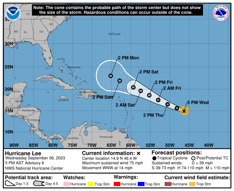
Hurricane Lee is churning towards the United States as a Category 5 storm. However, there is expected to be little, if any, impact on the Southeast, says Pam Knox, University of Georgia Extension Agricultural Climatologist.
“If you look at almost all the model runs that are coming through, they all turn way to the right long before it gets to land. The current model shows that it’s probably going to go north of Puerto Rico, and then shortly thereafter, it’s going to start turning pretty rapidly to the north,” Knox said. “I think it’s most likely going to thread the needle between the east coast of the United States and Bermuda. There’s a bare patch of ocean there where there’s not any land, because it’s east of the Bahamas and west of Bermuda. I don’t really see at this point that there’s a lot to worry about.
“It’s more than a week away so things can certainly change. But at this point in time, based on all the early models we’ve seen, it’s going to be a tremendous storm, but it’s most likely going to stay over the water. I think the biggest impacts as we see it now are likely going to be along the coast. There’s going to be high waves, certainly some riptides occurrence. There could be some coastal erosion, but I don’t necessarily see that there’s going to be much of any impact on the Southeast.”
Specialty crop farmers in Southeast Georgia and North Florida could use a break following the devastation left behind by Idalia. A substantial amount of Georgia’s pecan production was lost, while much of North Florida’s infrastructure (barns, shops, buildings) were impacted.


