


By Clint Thompson
The fall part of the year is normally a dry time for the Southeast region. This year’s conditions have been drier than normal, however, according to Pam Knox, University of Georgia (UGA) Extension agricultural climatologist.
“We’re a little stymied right now because a lot of the maps we usually look at haven’t been updated by NOAA which makes it a little tougher than usual to get a good handle on it,” Knox said. “My sense is that it’s been drier than usual. I think that is shown in the fact that the Drought Monitor people keep making the drought worse and worse over a lot of the region. (Recently) I got 2.5 inches of rain in Athens, and that’s going to really help. But not everybody in the Southeast got that. It was more in the northern part of Georgia than it was in the southern part of Georgia.”
Knox noted in a recent blog post that drier-than-normal conditions are expected for November, and the already-present drought will likely remain and expand into areas that currently do not have drought.
“This means that farmers who need to finish their crops like pecans will need to continue to irrigate until they are ready to harvest,” Knox wrote.
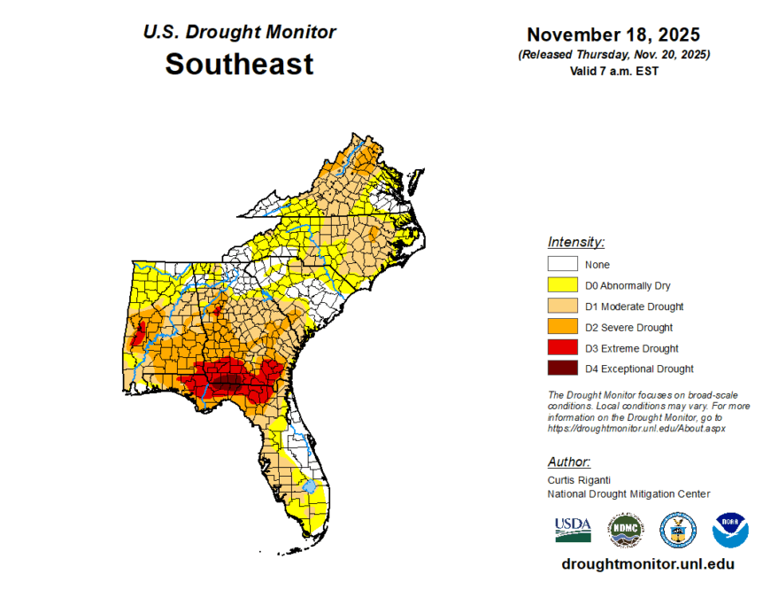
Extreme Drought
According to the Nov. 6 release of the U.S. Drought Monitor, extreme drought conditions are observed across South Georgia and North Florida. Georgia’s driest conditions start in Early and Seminole counties, extend eastward to Camden and Glynn counties and stretch as far north as Lee, Worth and Bacon counties.
Florida’s driest conditions start in Walton County and extend eastward to Columbia and Baker counties.